Log in
All resources
Create a design
9,296 Free Artworks of Map Collection
bibliothèque nationale de france
maps of spain by tomas lopez
eran laor cartographic collection
latin-language maps
koninklijke bibliotheek
joan blaeu
engraving on paper
national library of poland
copper engraving print
british library
maps of moers by johannes mercator
old maps of duisburg
vrbivm praecipvarvm totivs mvndi (1612)
maps of marchena by braun & hogenberg
atlas vingboons
1665
maps by hendrik hondius the younger
1630s maps of the world
maps from the mechanical curator collection available to georeference
maps from the mechanical curator collection
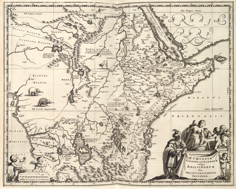
17th-century maps of africa
maps from gallica
daniel de la feuille
1708 maps
maps by jean-baptiste bourguignon d'anville
18th-century maps of western europe
picturesque tour from geneva to milan, by way of the simplon (1820)
maps from the mechanical curator collection
maps of spain by tomas lopez
old maps of navarre
maps of spain by tomas lopez
1765 maps of spain
maps of spain by tomas lopez
old maps of navarre
maps of spain by tomas lopez
1766 maps of spain
maps by jan eduard wagner
1890s maps of czechia
maps of spain by tomas lopez
1765 maps of spain
maps of spain by tomas lopez
old maps of navarre
maps of spain by tomas lopez
1765 maps of spain
maps of spain by tomas lopez
1765 maps of spain
maps of spain by tomas lopez
old maps of navarre
maps of álava-araba
1770 maps of spain
turgot map of paris, david rumsey historical map collection – derivative files
église saint-hippolyte (paris)
turgot map of paris, david rumsey historical map collection – derivative files
historical images of bièvre river in paris
turgot map of paris, david rumsey historical map collection – derivative files
collégiale saint-marcel (paris)
media from accademia delle scienze di torino
1573 maps of italy
kaart figuratief delft, tweede staat
collections of stadsarchief delft
atlas maior, vol 5 (england) - joan blaeu, 1667 - bl 114.h(star).5
old maps of anglo-saxon england
atlas maior, vol 2 (sweden, russia, poland, eastern europe, and greece) - joan blaeu, 1667 - bl 114.h(star).2
17th-century maps of finland
atlas maior, vol 5 (england) - joan blaeu, 1667 - bl 114.h(star).5
17th-century maps of norfolk, england
atlas maior, vol 12 (america) - joan blaeu, 1667 - bl 114.h(star).12
1667 maps
1660s maps of spain
1667 maps
old maps of the dutch east india company
1665
maps of mombasa by braun & hogenberg
maps of aden by braun & hogenberg
1840s maps showing history
maps by thomas starling
maps of mombasa by braun & hogenberg
maps of cefala by braun & hogenberg
maps of landrecies by braun & hogenberg
maps of beaumont by braun & hogenberg
maps by pieter van der keere
maps by abraham ortelius
maps by willem and johannes blaeu
1640s maps of ukraine
maps of neuss by braun & hogenberg
maps of bonn by braun & hogenberg
maps of neuss by braun & hogenberg
maps of bonn by braun & hogenberg
liber qvartvs contrafactur vnd beschreibung von den vornembsten stten der welt (zzk 0.32)
patrimonium 2 (project)
maps in the british museum
william lodge
maps in the british museum
old maps of leeds
liber qvartvs contrafactur vnd beschreibung von den vornembsten stten der welt (zzk 0.32)
patrimonium 2 (project)
maps in the biblioteca nacional do brasil
1587 maps
bird's eye view maps of pennsylvania
p.s. duval & son
old maps of rennes
adolphe périaux
maps by alexis-hubert jaillot
old maps of the tyrol
victor levasseur - maps of the world
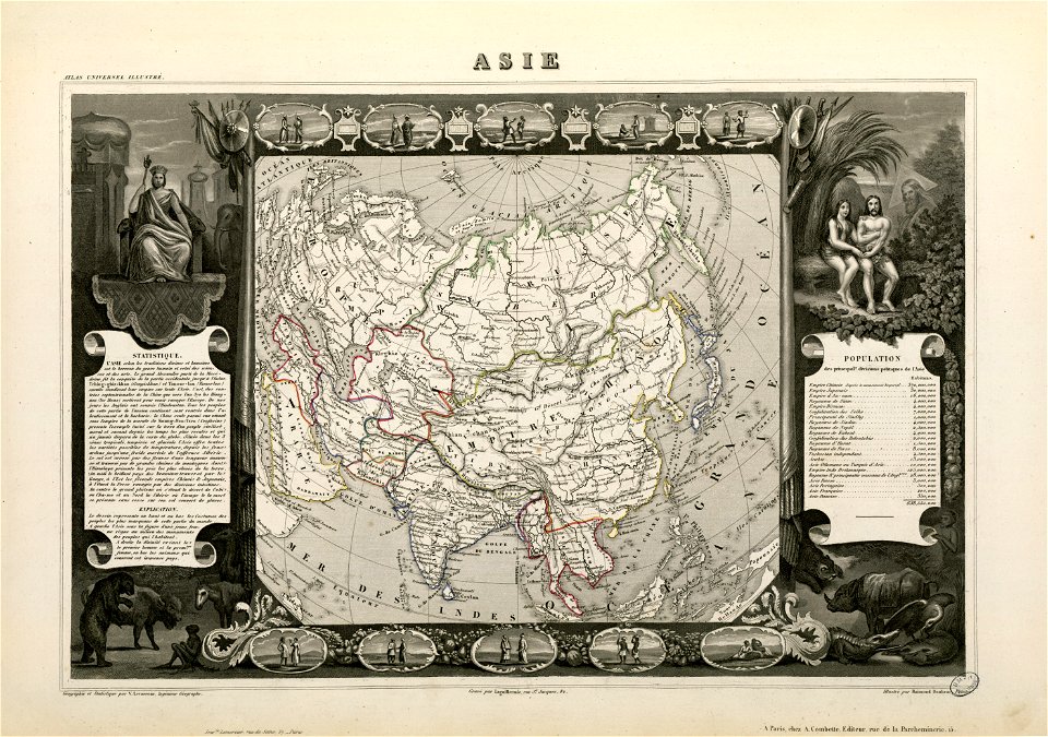
old maps of asia
beschreibung der städt der welt - braun & hogenberg - btv1b52512111k
dresden in the 1580s
eran laor cartographic collection
jacques chereau
turgot map of paris, david rumsey historical map collection – derivative files
couvent des célestins (paris)
hamburgische elbkarte von melchior lorichs
parts of old maps of hamburg
maps of paris from bibliothèque nationale de france
carte particulière des environs de paris
topographisch-historische ansicht der belagerung kopenhagens (1807)
maps from the mechanical curator collection
maps of hamburg by braun & hogenberg
bodleian maps collection
georg balthasar probst (1732-1801)
eran laor cartographic collection
eran laor cartographic collection
johann berka
eran laor cartographic collection
michel van lochom
eran laor cartographic collection
richard william seale
eran laor cartographic collection
richard william seale
eran laor cartographic collection
bolognino zaltieri
eran laor cartographic collection
richard william seale
eran laor cartographic collection
carolus allard
lithographs of paris
floor plans of paris
old maps of the dutch east india company - africa
1668
maps of the dutch east india company - south africa
1668
maps of the west-indische compagnie
1747 maps of africa
maps of the west-indische compagnie
1747 maps of africa
maps of the west-indische compagnie
1668 maps of africa
maps by willem and johannes blaeu
17th-century maps of sumatra
from edinburgh to the antarctic. an artist's notes and sketches during the dundee antarctic expedition of 1892-93
expedition maps
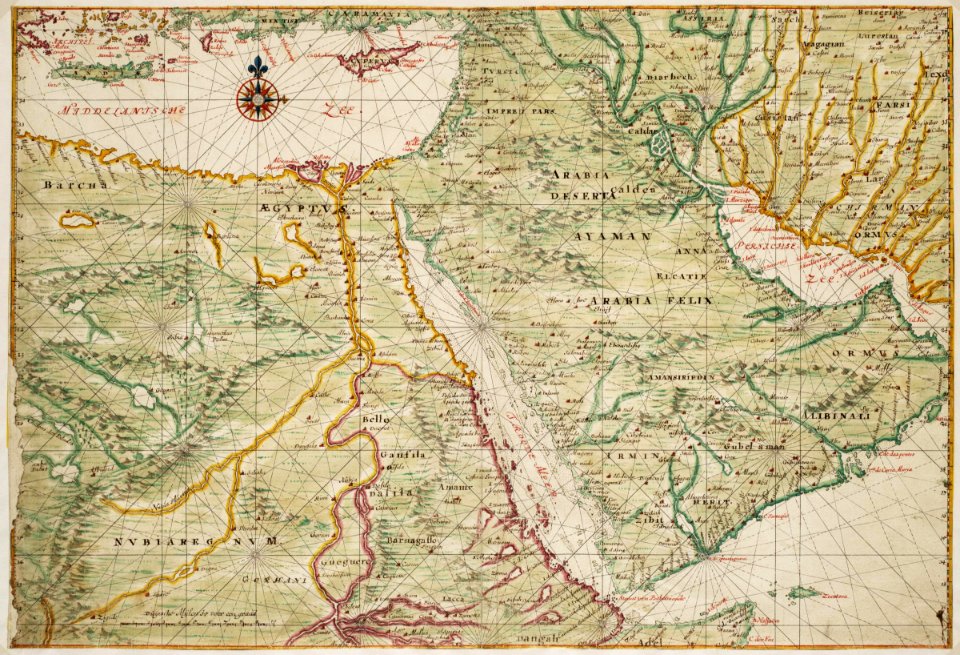
17th-century maps of the indian ocean
maps by willem and johannes blaeu
old maps of the dutch east india company - africa
1705
1570s maps of africa
1570s maps of egypt
plan routier de la ville et faubourg de paris by jean lattré
maps of paris from the stanford libraries
vrbivm praecipvarvm mvndi theatrvm qvintvm (1617)
maps of zell (mosel) by braun & hogenberg
maps by willem and johannes blaeu
chami empire
vrbivm praecipvarvm mvndi theatrvm qvintvm (1617)
maps of los palacios by braun & hogenberg
plan de la ville et faubourg de paris, divisé en ses 48 sections by mondhare & jean
maps of paris from the stanford libraries
architecture by michelangelo buonarroti
high renaissance,renaissance painting
maps by tomas lopez
1772 maps of asia
bibliothèque nationale de france
fra mauro map derivative works
picturesque tour from geneva to milan, by way of the simplon (1820)
maps from the mechanical curator collection
maps in the stadsarchief amsterdam
daniel stoopendaal
carte du mexique et de la floride by guillaume delisle (1703)
french-language maps of mexico
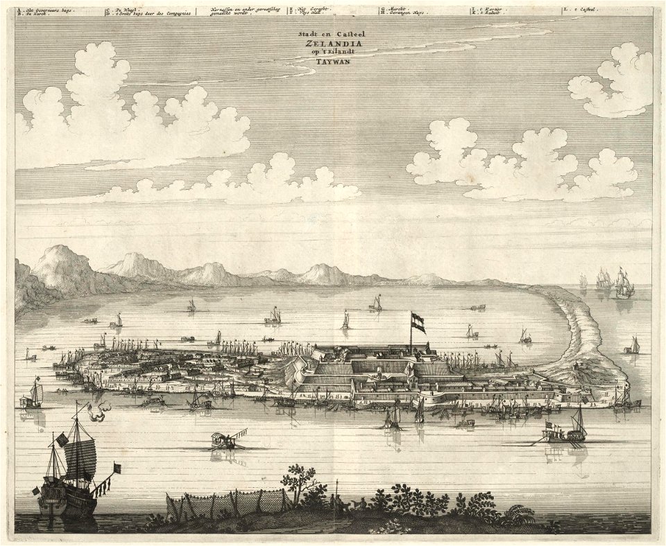
1670s works in taiwan
1670 maps
maps by thomas kitchin
old maps of scotland
maps from university of amsterdam special collections
atlas der neederlanden
map of brugse vrije by pieter claeissens de jonge
drawings in the groeningemuseum
maps of brest from bibliothèque nationale de france
lithographs of brest, france
male portrait paintings by james northcote
thomas hyde page
maps by pieter van der keere
old maps of liège (province)
maps in the staats- und universitätsbibliothek hamburg
1670s maps of hamburg
maps by thomas kitchin
1780 maps of africa
maps in the staats- und universitätsbibliothek hamburg
1670s maps of hamburg
maps from university of amsterdam special collections
atlas der neederlanden
maps from university of amsterdam special collections
atlas der neederlanden
1810s maps of the iberian peninsula
1813 maps of spain
maps by willem and johannes blaeu
maps made in the 17th century
drawings in the museu antônio parreiras
paper and graphite
2801 - 2900 of 9,296
Next page
/ 93